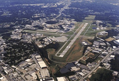
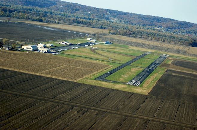
BNA -
Nashville Intl,
Nashville, TN
Any information displayed may not be accurate or current and should not be considered valid for navigation, flight planning, or for use in flight. Please consult official publications for current and correct information.
|
|
Location:
FAA Identifier:
|
BNA |
Latitude/Longitude:
|
36-07-28.1000N / 086-40-41.4000W 36.1245 / -86.6781
|
Elevation:
|
599 feet MSL (Surveyed) |
Magnetic Variation:
|
03W (2010)
|
Land Area Covered:
|
3900 acres
|
From City:
|
5 nautical miles SE of Nashville, TN
|
County/Parish:
|
Davidson, TN
|
 |
|
|
Airport Operations:
Airport Use:
|
Public
|
Activiation Date:
|
12/1/1937 12:00:00 AM
|
Sectional Chart:
|
Atlanta
|
Control Tower:
|
Yes
|
ARTCC:
|
Memphis Center (ZME)
|
FSS:
|
Nashville Flight Service Station ()
|
Attendance:
|
Continuous
|
Wind Indicator:
|
Yes - Lighted
|
Segmented Circle:
|
No
|
Lights:
|
Ss-Sr
|
Beacon:
|
White-Green (lighted land airport)
|
International Operations:
|
No
|
Landing Fee:
|
No
|
 |
|
|
Communications:
Unicom:
|
122.95 |
LCL/P
|
257.8 |
LCL/P
|
118.6 |
GND/P
|
348.6 |
GND/P
|
121.9 |
EMERG
|
121.5 |
EMERG
|
243.0 |
DEP/P CLASS C
|
372.0 WEST |
DEP/P CLASS C
|
119.35 WEST |
DEP/P
|
360.7 EAST |
DEP/P
|
118.4 EAST |
D-ATIS
|
135.1 |
CD/P PTC
|
126.05 |
APCH/P CLASS C IC
|
118.4 EAST |
APCH/P CLASS C IC
|
360.7 EAST |
APCH/P
|
372.0 WEST |
ALCP
|
314.4 |
ASR-9 ELEV 609.9 FT. |
 |
|
|
Services:
Fuel available:
|
100LL Jet-A |
Airframe Repair:
|
Major |
Power Plant Repair:
|
Major |
Bottled oxygen:
|
Low |
Bulk oxygen:
|
Low |
 |
|
|
Runway Information:
Runway: |
02C/20C |
Dimensions:
|
8001 x 150 ft. |
Surface:
|
Portland cement concrete - in good condition |
Surface Treatment:
|
Saw-cut or plastic groove |
Weight Bearing Capacity:
|
Single wheel: |
75 K lbs. |
Double wheel: |
209 K lbs. |
Double tandem: |
350 K lbs. |
|
Runway Edge Lights:
|
High intensity |
 |
|
 |
Runway 02C |
 |
Runway 20C |
Latitude: |
36-06-11.9905N |
Latitude: |
36-07-27.2404N |
Longitude: |
086-41-16.6587W |
Longitude: |
086-40-46.5498W |
Elevation: |
569 ft. |
Elevation: |
572 ft. |
Gradient: |
0.5% |
Gradient: |
0.5% |
Traffic Pattern: |
Left |
Traffic Pattern: |
Left |
Displaced Threshold: |
No |
Displaced Threshold: |
No |
Declared distances: |
8000 Feet - Actual Stop Distance Available. 8000 Feet - Take Off Distance Available. 8000 Feet - Landing Distance Available. 8000 Feet - Take Off Run Available.
|
Declared distances: |
8000 Feet - Actual Stop Distance Available. 8000 Feet - Take Off Distance Available. 8000 Feet - Landing Distance Available. 8000 Feet - Take Off Run Available.
|
Markings: |
PIR - Precision instrument, Good condition |
Markings: |
PIR - Precision instrument, Good condition |
Visual Glide Angle: |
° |
Visual Glide Angle: |
3° |
RVR Equipment: |
touchdown |
RVR Equipment: |
rollout |
Approach Lights: |
MALSR |
Approach Lights: |
|
Runway End Identifier Lights: |
|
Runway End Identifier Lights: |
Yes |
 |
|
 |
|
Runway: |
02L/20R |
Dimensions:
|
7704 x 150 ft. |
Surface:
|
Portland cement concrete - in good condition |
Surface Treatment:
|
Saw-cut or plastic groove |
Weight Bearing Capacity:
|
Single wheel: |
100 K lbs. |
Double wheel: |
200 K lbs. |
Double tandem: |
390 K lbs. |
|
Runway Edge Lights:
|
High intensity |
 |
|
 |
Runway 02L |
 |
Runway 20R |
Latitude: |
36-07-03.6337N |
Latitude: |
36-08-16.2327N |
Longitude: |
086-41-11.3102W |
Longitude: |
086-40-42.8381W |
Elevation: |
599 ft. |
Elevation: |
556 ft. |
Gradient: |
0.6% |
Gradient: |
0.6% |
Traffic Pattern: |
Left |
Traffic Pattern: |
Left |
Displaced Threshold: |
No |
Displaced Threshold: |
No |
Declared distances: |
7702 Feet - Actual Stop Distance Available. 7702 Feet - Take Off Distance Available. 7702 Feet - Landing Distance Available. 7702 Feet - Take Off Run Available.
|
Declared distances: |
7702 Feet - Actual Stop Distance Available. 7702 Feet - Take Off Distance Available. 7702 Feet - Landing Distance Available. 7702 Feet - Take Off Run Available.
|
Markings: |
PIR - Precision instrument, Good condition |
Markings: |
PIR - Precision instrument, Good condition |
Visual Glide Angle: |
° |
Visual Glide Angle: |
3° |
RVR Equipment: |
touchdown, rollout |
RVR Equipment: |
touchdown, rollout |
Approach Lights: |
ALSF2 |
Approach Lights: |
MALSF |
Centerline Lights: |
Yes |
Centerline Lights: |
Yes |
Touchdown Lights: |
Yes |
Touchdown Lights: |
No |
 |
|
 |
|
Runway: |
02R/20L |
Dimensions:
|
8001 x 150 ft. |
Surface:
|
Portland cement concrete - in fair condition |
Surface Treatment:
|
Saw-cut or plastic groove |
Weight Bearing Capacity:
|
Single wheel: |
75 K lbs. |
Double wheel: |
209 K lbs. |
Double tandem: |
350 K lbs. |
|
Runway Edge Lights:
|
High intensity |
 |
|
 |
Runway 02R |
 |
Runway 20L |
Latitude: |
36-06-45.7669N |
Latitude: |
36-08-01.0115N |
Longitude: |
086-40-03.5139W |
Longitude: |
086-39-33.3955W |
Elevation: |
590 ft. |
Elevation: |
540 ft. |
Traffic Pattern: |
Left |
Traffic Pattern: |
Left |
Displaced Threshold: |
No |
Displaced Threshold: |
No |
Declared distances: |
8000 Feet - Actual Stop Distance Available. 8000 Feet - Take Off Distance Available. 8000 Feet - Landing Distance Available. 8000 Feet - Take Off Run Available.
|
Declared distances: |
8000 Feet - Actual Stop Distance Available. 8000 Feet - Take Off Distance Available. 8000 Feet - Landing Distance Available. 8000 Feet - Take Off Run Available.
|
Markings: |
PIR - Precision instrument, Good condition |
Markings: |
PIR - Precision instrument, Good condition |
Visual Glide Angle: |
3° |
Visual Glide Angle: |
° |
RVR Equipment: |
touchdown, midfield, rollout |
RVR Equipment: |
touchdown, midfield, rollout |
Approach Lights: |
ALSF2 |
Approach Lights: |
MALSR |
Centerline Lights: |
Yes |
Centerline Lights: |
Yes |
Touchdown Lights: |
Yes |
Touchdown Lights: |
No |
 |
|
 |
|
Runway: |
13/31 |
Dimensions:
|
11030 x 150 ft. |
Surface:
|
Portland cement concrete - in good condition |
Surface Treatment:
|
Saw-cut or plastic groove |
Weight Bearing Capacity:
|
Single wheel: |
75 K lbs. |
Double wheel: |
175 K lbs. |
Double tandem: |
250 K lbs. |
|
Runway Edge Lights:
|
High intensity |
 |
|
 |
Runway 13 |
 |
Runway 31 |
Latitude: |
36-08-28.5987N |
Latitude: |
36-07-13.7846N |
Longitude: |
086-41-43.2780W |
Longitude: |
086-40-05.4380W |
Elevation: |
536 ft. |
Elevation: |
582 ft. |
Gradient: |
0.4% |
Gradient: |
0.4% |
Traffic Pattern: |
Left |
Traffic Pattern: |
Left |
Displaced Threshold: |
801 ft. |
Displaced Threshold: |
741 ft. |
Declared distances: |
10288 Feet - Actual Stop Distance Available. 11029 Feet - Take Off Distance Available. 9487 Feet - Landing Distance Available. 10288 Feet - Take Off Run Available.
|
Declared distances: |
10228 Feet - Actual Stop Distance Available. 11029 Feet - Take Off Distance Available. 9487 Feet - Landing Distance Available. 10228 Feet - Take Off Run Available.
|
Markings: |
PIR - Precision instrument, Good condition |
Markings: |
PIR - Precision instrument, Good condition |
Visual Glide Angle: |
3.25° |
Visual Glide Angle: |
° |
Runway End Identifier Lights: |
Yes |
Runway End Identifier Lights: |
Yes |
 |
|
 |
|
|
Airport Ownership and Management:
Ownership:
|
Publicly Owned |
Owner:
|
Metro Nashville Arpt Auth One Terminal Dr. Suite 501 Nashville, TN 37214 615-275-1600
|
Manager:
|
Rob Wigington One Terminal Dr. Suite 501 Nashville, TN 37214 615-275-1703
|
 |
|
|
Remarks:
- LIGHTED JET BLAST FENCE 598 MSL 1100 FT SE OF RY 31 THLD.
- LIGHTED JET BLAST FENCE 568 FT MSL 1167 FT NW RY 13 THLD.
- NO UNAUTHORIZED 180 DEG TURNS FOR ACFT OVER 12500 LBS ON ASPHALT SURFACES.
- NO FLIGHT OVER MAIN TERMINAL BLDG IS PERMITTED.
- BIRD ACTIVITY ON & INVOF ARPT.
- DO NOT CONFUSE 150 FT WIDE TWY S FOR RY 20C.
- 'C' CONCOURSE TAXILANES ARE; INNER TAXILANE FOR OUTBOUND TFC & OUTER TAXILANE FOR INBOUND TFC.
- READ BACK OF ALL RY HOLDING INSTRUCTIONS IS REQUIRED.
- ANG: CALL SIGN MUSIC CITY OPS.
- TAXIWAY K4 HAS BEEN REMOVED DURING CONSTRUCTION.
- ARNG - PPR CTC 615-367-5567.
- FLIGHT NOTIFICATION SERVICE (ADCUS) AVAILABLE.
- PILOTS COMPLY WITH ALL HOLD SHORT INSTRUCTIONS PARTICULARLY AT TWY K & RY 20C APCH; TWY L8 & RY 31 APCH; TWY L AT RY 13 APCH; AND TWY H AT RY 31 APCH.
- ALL TURBOJET RYS HAVE NOISE ABATEMENT PROCEDURES. MIL FIGHTER/ATTACK/TRAINER TURBOJETS USE RY 13/31 FOR ARRIVAL & DEPARTURE.
- UPWND: TCH 113.6' GLIDE ANGLE 3.25 DEG; DWNWND: TCH 43.5' GLIDE ANGLE 2.75 DEG.
- APCH RATIO 50:1 TO DSPLCD THR.
|
|
FunPlacesToFly.com and OpenAirNet Inc. shall not be held liable
for any financial loss, damages or injury due the use of, or reference
to the information displayed above. Always call ahead to
confirm any information listed and the existence of the destination.
Any information displayed may not be accurate or current and should
not be considered valid for navigation, flight planning, or for use in flight.
Please consult official publications for current and correct information.
Please read our Disclaimer.
|
|