


Extreme Crosswind Landing in a Cessna 172 - #gopro #crosswind #aviation #airport #flighttraining
- FunPlacesToFly.com

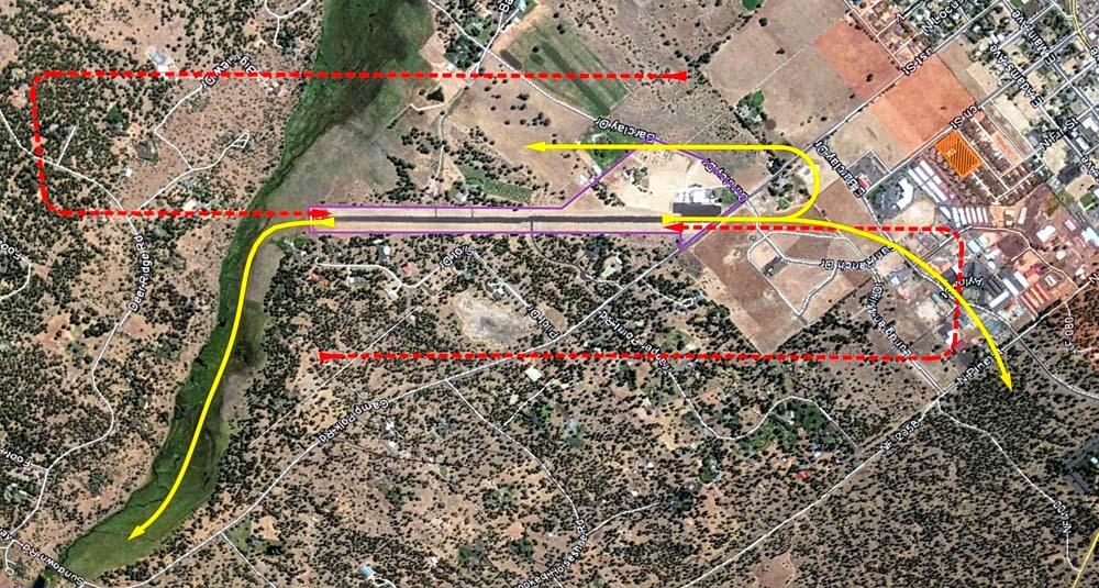
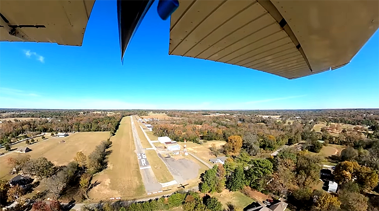
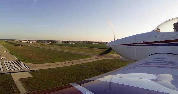
http://FunPlacesToFly.com On this particular day, we had an extreme crosswind, straight across the r...

We are having a annual FLY-IN Picnic. We'll have lots of FREE food, airplanes and fellowship. If wea...
Cessna 172 Crosswind Landing - 25 mph Gusts - Stratus ADS-B View
- FunPlacesToFly.com

On this particular day, we had an extreme crosswind,straight across the runway with winds gusting at...

"The Pub McDonough is Granbury's only traditional Irish Pub. Serving up great food, music drin...
Could this mini turbine engine revolutionize general aviation?
- AOPA: Your Freedom to Fly

Fly along with AOPA Editor at Large Dave Hirschman in a Bristell light sport airplane equipped with ...
I didn't want to make this video...
- Angle of Attack

In this video, we address the recent spate of aviation accidents and incidents that have captivated ...
Wisconsin National Guard Combined Arms Demonstration - EAA AirVenture Oshkosh 2024
- AirshowStuffVideos

The Wisconsin National Guard performs a combined arms firepower demonstration during the Friday airs...
REBUILDING A 1947 CESSNA FROM SCRATCH
- Jimmys World

There's no going back. We are rebuilding this 1947 Cessna 120 from scratch....

"Wanted to write about my local airport at Niagara Falls.
Firstly, if you never done it you can ...

"Great friendly airport with bicycles you can borrow. Two segments of the Mountain Goat Trail a...

"Land to the west, takeoff to the east on the best grass strip you have ever landed on. Tiedow...

"If you need a place to visit in the Atlanta area, Museum of Flight is a cool little museum to ...

"Join Airbatic Adventures on cross country to Ocracoke Island located in the Outer Banks of Nor...

"Just a mile from KMRT is both the Red Shed BBQ and Benny's Pizza. Great food at either locati...
World's Longest flight
- Just Plane Silly

🚀 How long can a plane stay in the air without landing? From daring pilots in the 1920s to t...
Rotax Expert Inspects My Abandoned Flying Boat
- Jimmys World

I bought a flying boat that has been sitting for over 8 years. Rotax expert inspects my abandoned f...