




FunPlacesToFly.com is an Amazon Associate. As an Amazon Associate we earn from qualifying purchases.
Fun Places to Fly, Aviation Jobs and More!
Thursday - Saturday, Jul 23-25, 2026
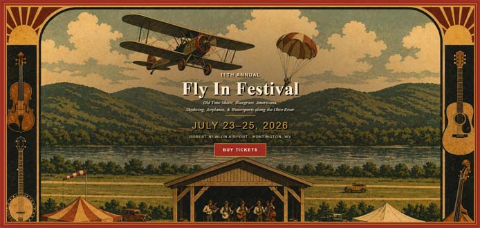
Fly In Festival 11th Annual, Huntington, WV
* * Search for More Events by Zip Code or Airport ID!
* * Print out a Flyer for this EVENT!
Share on:
All destinations and events listed on this website were provided by visitors to our website. If you decide to fly or drive to any destination listed, you do so at your own risk.
Please see our disclaimer.
Robert Newlon Airport (I41), Huntington, WV
The 11th Annual Fly In Festival is a three-day bluegrass, old-time, and Americana music weekend held July 23-25, 2026 at Robert Newlon Airport I41 in Huntington, WV.It takes place at a working regional airport, with the runway right behind the stage skydiving demonstrations, fly-overs, and aircraft are part of the weekend alongside the music.
The 2026 lineup is led by The Bing Brothers and Jake Krack, with Jason Carter, Appalachian Road Show, Kenny Amanda Smith Band, Kevin Denney Neo-Grass, Chris Davis Band, and over two dozen more acts. Thursday potluck dinner, late-night jamming all weekend, and a Saturday morning kayak float on the Ohio River. On-site camping available. Tickets: Weekend $100 / Daily $45 / Camping $40. Proceeds benefit Barboursville Bloodhounds, a 501c3 supporting the Barboursville PD K-9 unit. flyinfestival.com
Contact: Fly In Festival
Phone: 304 733-1240
Website: https://flyinfestival.com
Airport Information:
Robert Newlon Field (I41)
More info from AirNav.com
Latitude: 38-27-25.3040N
Longitude: 082-18-49.5360W
Elevation: 550
Fuel: 100LL
CTAF: 122.9
Unicom:
Robert Newlon Field (I41)
More info from AirNav.com
Latitude: 38-27-25.3040N
Longitude: 082-18-49.5360W
Elevation: 550
Fuel: 100LL
CTAF: 122.9
Unicom:






Nearby Public Airports: (50 mile radius)
|
Advertise with us!
 |
 |
 |
 |
 |
 |
 |
 |
 |
 |
 |
 |
 |
 |
 |