Aviation Events, Places to Fly and MORE!

Pocono Mountains, Mount Pocono, PA (KMPO)

Search More Places to Fly:
Your Airport ID:
* OR *
Your Zip Code:
Range (miles):

How far is that Airport?
Distance Calculator!

Aviation Events Calendar
Receive our Email Newsletters about upcoming Aviation Events, Great Places to Fly and Videos! Post our Flyer!
Add Your Favorite Place to Fly!
Add Your Aviation Event!

Pocono Mountains

Flew in for a one-night trip to Camelback Resort Aquatopia water park. Local Enterprise arranged for drop-off and pick-up at airport box available for after-hours drop-off. Kalahari and Great Wolf Lodge are two other nearby options with indoor water parks. For size reference, Great Wolf Lodge's waterpark is the smallest at about 79,000 square feet. Kalahari is the largest at 220,000 square feet and Camelback's Aquatopia is right in the middle at 125,000 square feet. These resorts also offer zip lines and other amenities. Airport facilities and personnel were great - $10 tie-down fee per night no ramp/landing fees. - Submitted by Meaghan
All destinations and events listed on this website were provided by visitors to our website. If you decide to fly or drive to any destination listed, you do so at your own risk. Please see our disclaimer.


Amenities:
100LL Camping Courtesy Car(s)
FBO Fishing Flight Planning Room
Hiking Hotels Near Airport Pilot Lounge
Rental Cars Restrooms Tiedowns
How far away is Pocono Mountains?
From Airport ID:
To Airport ID:
Mileage Type:
Visit this Website:
https://www.mpoairport.com/
Airport Information:
Pocono Mountains Muni (MPO)

More info from AirNav.com

Latitude: 41-08-15.7000N
Longitude: 075-22-48.2000W
Elevation: 1915
Fuel: 100LL Jet-A
CTAF: 122.7
Unicom: 122.7

Try Our Trip Calculator!


See it on a Large Google Map!

Location:
Mount Pocono, PA
Comments and Reviews From FunPlacesToFly.com Visitors:
Write a review, suggest updates or make comments!
  • No reviews so far
FunPlacesToFly.com is an Amazon Associate. As an Amazon Associate we earn from qualifying purchases.
Nearby Public Airports: (50 mile radius)
ID Name City/State/Use Chart Name Distance
8N4 Flying Dollar Canadensis, PA
Public
New York 9 miles
N53 Stroudsburg-Pocono East Stroudsburg, PA
Public
New York 13 miles
70N Spring Hill Sterling, PA
Public
New York 15 miles
AVP Wilkes-Barre/scranton Intl Wilkes-Barre/scranton, PA
Public
New York 23 miles
1N7 Blairstown Blairstown, NJ
Public
New York 23 miles
14N Beltzville Lehighton, PA
Public
New York 24 miles
WBW Wilkes-Barre Wyoming Valley Wilkes-Barre, PA
Public
New York 27 miles
N30 Cherry Ridge Honesdale, PA
Public
New York 27 miles
N43 Braden Airpark Easton, PA
Public
New York 28 miles
69N Slatington Slatington, PA
Public
New York 28 miles
22N Jake Arner Memorial Lehighton, PA
Public
New York 30 miles
P91 Flying M Aerodrome Germansville, PA
Public
New York 32 miles
13N Trinca Andover, NJ
Public
New York 33 miles
HZL Hazleton Rgnl Hazleton, PA
Public
New York 34 miles
ABE Lehigh Valley Intl Allentown, PA
Public
New York 34 miles
12N Aeroflex-Andover Andover, NJ
Public
New York 35 miles
N05 Hackettstown Hackettstown, NJ
Public
New York 35 miles
9N3 Seamans Field Factoryville, PA
Public
New York 37 miles
XLL Allentown Queen City Muni Allentown, PA
Public
New York 40 miles
FWN Sussex Sussex, NJ
Public
New York 40 miles
76N Skyhaven Tunkhannock, PA
Public
New York 40 miles
N85 Alexandria Pittstown, NJ
Public
New York 42 miles
N40 Sky Manor Pittstown, NJ
Public
New York 45 miles
9N1 Vansant Erwinna, PA
Public
New York 47 miles
UKT Quakertown Quakertown, PA
Public
New York 49 miles
MSV Sullivan County Intl Monticello, NY
Public
New York 49 miles
Photos:
All photos shown below are provided/uploaded by visitors to our website, which have agreed to our Photo Submission Rules.
Got a photo?, share it with us


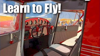
Pocono Mountains - Uploaded by Mike

Fun Places to Fly Search:
Your Airport ID:
* OR *
Your Zip Code:
Range (miles):
Airport Search:
ID, Name
or City:
State:
Airport Distance Calculator:
From Airport ID:
To Airport ID:
Mileage Type:
Put this on your Website!

FunPlacesToFly.com is owned and maintained by OpenAirNet Inc. All rights reserved. WrapBootStrap.com Licensed Website. For more information, contact us.

OpenAirNet Incorporated and FunPlacesToFly.com. Unauthorized use and/or duplication of this material without express and written permission from this site's author and/or owner is strictly prohibited. Excerpts and links may be used, provided that full and clear credit is given to OpenAirNet Incorporated and FunPlacesToFly.com with appropriate and specific direction to the original content.