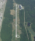
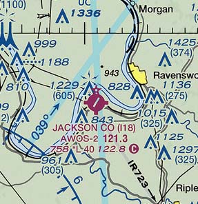
Jackson County Airport
|
Nice friendly people always around on the weekends. The Jackson County Airport is located on the Ohio River in western West Virginia. They have flight training and maintenance facilities located on the airport to serve the general aviation community. Browse their site and visit them to get a sense of why they call the Jackson County Airport The Friendly Airport. - Submitted by Mike
All destinations and events listed on this website were provided by visitors to our website. If you decide
to fly or drive to any destination listed, you do so at your own risk. Please see our disclaimer.
|
|
Amenities:  100LL 100LL
 Flight Training Flight Training
 Hangars Hangars
 Maintenance Maintenance
 Pilot Lounge Pilot Lounge
 Pilot Supplies Pilot Supplies
 Rental Cars Rental Cars
 Tiedowns Tiedowns
 WIFI WIFI
|
Contact Information:
Phone: (304) 273-8114
Phone: (304) 273-8114
Airport Information:
|
Jackson County (I18) Latitude: 38-55-47.2000N |
|
|
Location:
|
912 Airport Road Millwood, WV |
Comments and Reviews From FunPlacesToFly.com Visitors:
Write a review, suggest updates or make comments!
10/17/2018 - Called the airport and he said the cafe has been closed for several years - Submitted by Gregory Cook
8/22/2003 - 100 LL Credit Card Pump now in service for 24 hour refueling. Accepts all major cards.
Write a review, suggest updates or make comments!
10/17/2018 - Called the airport and he said the cafe has been closed for several years - Submitted by Gregory Cook
8/22/2003 - 100 LL Credit Card Pump now in service for 24 hour refueling. Accepts all major cards.
Nearby Public Airports: (50 mile radius)
|
Photos:
All photos shown below are provided/uploaded by visitors to our website, which have agreed to our Photo Submission Rules.
Got a photo?, share it with us

I18 Ravenswood, Jackson County ,WV. Rwys 4 and 22 4000 x 75 FT.Paved AWOS 121.3 on field, Pilot controled Rwy lights. UNICOM 122.8. Hours 9-5 daily except Holidays. Cafe open on field on week ends. - Uploaded by Edward
All photos shown below are provided/uploaded by visitors to our website, which have agreed to our Photo Submission Rules.
Got a photo?, share it with us

I18 Ravenswood, Jackson County ,WV. Rwys 4 and 22 4000 x 75 FT.Paved AWOS 121.3 on field, Pilot controled Rwy lights. UNICOM 122.8. Hours 9-5 daily except Holidays. Cafe open on field on week ends. - Uploaded by Edward
FunPlacesToFly.com is an Amazon Associate. As an Amazon Associate we earn from qualifying purchases.
Advertise with us!
 |
 |
 |
 |
 |
 |
 |
 |
 |
 |
 |
 |
 |


