
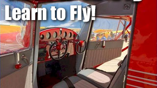
Fun Places to Fly, Aviation Jobs and More!


Terre Haute Regional Airport

HUF is a GA airport located approximately 6 miles east of downtown Terre Haute. HUF has a top notch FBO Hoosier Aviation, a bustling restaurant Corsair Cafe, along with many other businesses supporting those in the aviation industry.
All destinations and events listed on this website were provided by visitors to our website. If you decide
to fly or drive to any destination listed, you do so at your own risk. Please see our disclaimer.
The city of Terre Haute has TONS to do with several hotels and eateries, making it a perfect weekend destination. - Submitted by Kelsey |
|
Amenities:  100LL
Aircraft Rental
Avgas
Complimentary Coffee
Computerized Weather
Conference Rooms
Courtesy Car(s)
FBO
Flight Planning Room
Flight Training
Food
Gift Shop
Hangar Leasing/Sales
Hangars
Hotels Near Airport
Maintenance
Office Space
Pilot Lounge
Pilot Supplies
Rental Cars
Restrooms
Sightseeing
Store(s)
Terminal/Lounge
Tiedowns
Transportation
Vending Machines
WIFI 100LL
Aircraft Rental
Avgas
Complimentary Coffee
Computerized Weather
Conference Rooms
Courtesy Car(s)
FBO
Flight Planning Room
Flight Training
Food
Gift Shop
Hangar Leasing/Sales
Hangars
Hotels Near Airport
Maintenance
Office Space
Pilot Lounge
Pilot Supplies
Rental Cars
Restrooms
Sightseeing
Store(s)
Terminal/Lounge
Tiedowns
Transportation
Vending Machines
WIFI
|
Airport Information:
|
Terre Haute Intl-Hulman Field (HUF) Latitude: 39-27-05.3000N |
|
|
Location:
|
Terre Haute, IN |
Comments and Reviews From FunPlacesToFly.com Visitors:
Write a review, suggest updates or make comments!
Write a review, suggest updates or make comments!
- No reviews so far
Nearby Public Airports: (50 mile radius)
|
Photos:
All photos shown below are provided/uploaded by visitors to our website, which have agreed to our Photo Submission Rules.
Got a photo?, share it with us
Terre Haute Regional Airport - Uploaded by Mike
All photos shown below are provided/uploaded by visitors to our website, which have agreed to our Photo Submission Rules.
Got a photo?, share it with us
Terre Haute Regional Airport - Uploaded by Mike
FunPlacesToFly.com is an Amazon Associate. As an Amazon Associate we earn from qualifying purchases.


Advertise with us!
 |
 |
 |
 |
 |
 |
 |
 |
 |
 |
 |