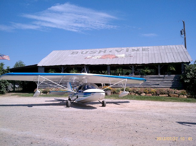
Bush N Vine
|
Great grass strip with vegetable / fruit stand at the north end. Park on the north end of the runway and walk to the stand for a fresh strawberry or peach slushy. Plus it's a great place to get strawberries, blackberries, peaches and veggies in season. Traffic uses 122.9 - Submitted by Dennis Scearce
All destinations and events listed on this website were provided by visitors to our website. If you decide
to fly or drive to any destination listed, you do so at your own risk. Please see our disclaimer.
|
|
Amenities:  Maintenance Maintenance
 Tiedowns Tiedowns
|
Airport Information:
|
York (01SC) Latitude: 35-01-55.4860N |
|
|
Location:
|
York, SC |
Comments and Reviews From FunPlacesToFly.com Visitors:
Write a review, suggest updates or make comments!
5/1/2015 - Freq is 122.9 always has been - Submitted by Eddie
10/15/2014 - Freq at York.sc is 122.9. Land on 36 if winds allow - Submitted by eddie
8/14/2014 - Frequency at 01SC York, SC is 122.9. great grass field with 2600 ft with great approaches..Corn is now being pulled. - Submitted by Eddie Shields
Nearby Public Airports: (50 mile radius)
|
Photos:
All photos shown below are provided/uploaded by visitors to our website, which have agreed to our Photo Submission Rules.
Got a photo?, share it with us

Bush N Vine - Uploaded by Ted Wilson
All photos shown below are provided/uploaded by visitors to our website, which have agreed to our Photo Submission Rules.
Got a photo?, share it with us

Bush N Vine - Uploaded by Ted Wilson
FunPlacesToFly.com is an Amazon Associate. As an Amazon Associate we earn from qualifying purchases.
Advertise with us!
 |
 |
 |
 |
 |
 |
 |
 |
 |
 |
 |
 |
 |


